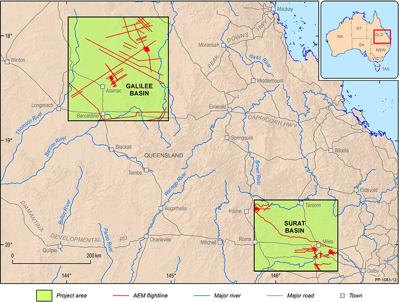
This project collected airborne electromagnetic (AEM) data across 2 areas: the Surat and Galilee geological basins.
These data were released for inclusion in future studies and have been combined with other geophysical and geological data to characterise aquifer architecture in the Australian Government funded project Assessing the status of groundwater in the Great Artesian Basin.
AEM provides a potential cost-effective alternative to map near-surface Neogene faults (<100 to 200 m below surface). The lower per-kilometre costs of AEM data acquisition compared to seismic reflection data enable industries, government and academia to collect more data and better understand aquifer hydrodynamics and structural compartmentalisation of sedimentary basins.
Outputs
New data acquisition
The Surat-Galilee project acquired 4,767 line kilometres of AEM data across parts of the Surat and Galilee geological basins in 2017. The survey acquired data either coincident or proximal to existing seismic reflection surveys for ease of comparison between 2 datasets. Geoscience Australia used these new AEM data to aid interpretation as part of the Assessing the status of groundwater in the Great Artesian Basin project.
Publications and reports
- Ray A, Cathro D, Hostetler S, Symington N, Taylor RL, Carey H 2021. Surat-Galilee Region AEM SkyTEM airborne electromagnetic survey. Geoscience Australia, Canberra
Extended abstracts
- Lawrie, K., Cathro, D., Symington, N., Christensen, N.B., Harris-Pascal, C., Tan, KP, McPherson, A., Gow, L. 2018. Utilization of AEM Methods for Cost-Effective Mapping of Shallow Neogene Intra-Plate Fault Systems in Eastern Australian Coal Seam Gas Basins. ASEG Extended abstracts, December 2018.
